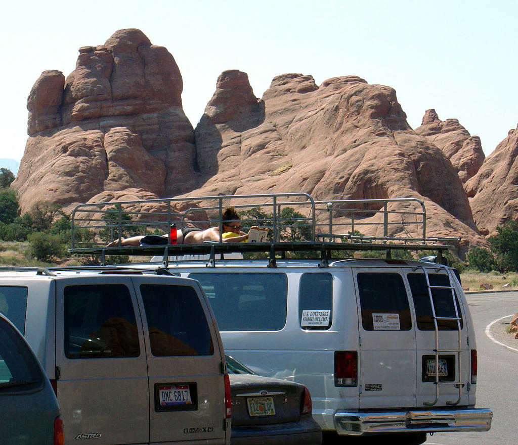
We did get out pretty promptly (for us), so it wasn't TOO hot by the time we got to the Devil's Garden parking lot for our hike out to Landscape and Double O arches. One demented sun-worshiper was even working on their tan in a bikini while reading Bulfinch's Mythology. The paramedics must have taken her away by the time we returned, because she wasn't up there.
As you might expect, the trail began pretty crowded with families of all shapes and sizes, many with only flip-flops, a little water bottle, and no head coverage. We looked overdone in comparison with hydration packs, boots, hats, and walking staffs...but I know we were more comfortable. There's just something sinful about being able to take a drive of cold water out in the middle of the hot desert!
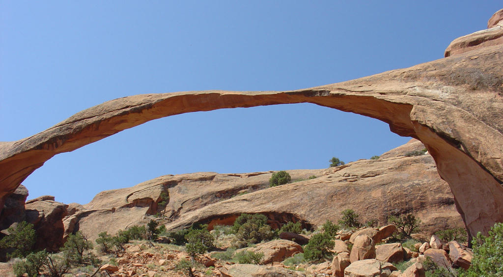
Landscape Arch is long and delicate (remember I said it was originally supposed to be named Delicate Arch), and you can't go under it any more after a rockfall (on the right) caused many tons of it to shave off in the 70's. It's very sandy at the observation area, so it felt especially especially hot.
We didn't linger long here, but continued onward towards Double O Arch. The trail immediately
 becomes less manicured (i.e., more interesting) and less populated (i.e. more peaceful), and we clambered up and down through slickrock valleys and ridges, and along narrow rock fins to get to our destination. Hiking on the slickrock formations in Utah is like a playground for grownups!
Double O Arch is named for the two holes in a slickrock fin that wind and rain have carved over
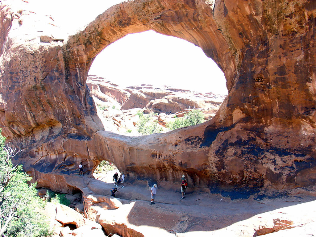 time. Smooth and beautifully rounded, it's quite
 comfortable to sit in the smaller "O" and relax. You're in the shade, and the opening (which was created by the wind, after all) focuses the breeze nicely on you. We had lunch there and clambered around on the beautiful formations.
The day was heating up rapidly, so we hustled back to the crowds and the parking lot. A great way to spend the morning, but we still had Canyonlands to go.
After a relaxing lunch in Moab, we headed out to Canyonlands. This NP is north and west of Moab, and . It's huge (527 square miles!), has little in the way of tourist facilities, and is forbiddingly hot in the summer and remote. It's also an amazing place. When people think of vast canyons, of course they think of the Grand Canyon. It's still my favorite, but Canyonlands is awe-inspiring in a different dimension: instead of one gigantic, hard-to-comprehend canyon, viewing Canyonlands from Grand View point brings you innumerable smaller canyons as far as the eye can see across 270 degrees of view. And "smaller" is a relative term; most of them are well over 1000' deep. If you look carefully at the photo in the Grand View point link, you'll see fine lines around the aptly-named White Rim. That's a jeep track that's wide enough to hold two jeeps side by side most places!
Canyonlands is split into three districts by the Green and Colorado rivers, which form sort of a "Y" in the park. The place where the two rivers meet is known as the Confluence. The upper section is called Island In The Sky because it's on a huge mesa that overlooks all the canyons. Grand View Point is on the southern tip of the mesa. The lower right is the Needles District, named for the needle-like formations found there. If you look at the map of the Grand View point photo, you'll see markers for the confluence on the right...but you still can't even see any rivers because it's so convoluted.
And the lower-left (southwestern) district is aptly named The Maze, for its many little-explored maze-like canyons. The Maze is the least accessible, and least visited section of land in the lower 48. It really wasn't even explored until the late 50's and early 60s. The ranger station on the west side is a 2 1/2 hour drive from the closest town, the last 46 miles on a dirt road. The canyons of The Maze are another 3 to 6 hours using high-clearance 4WD vehicles. We got close on the east side by floating down past the confluence to Spanish Bottom, hiking 1000' to the top of the river canyon, hking another mile or so inland...and we still didn't get to where we could see any of the maze canyons. (More on this later.) Edward Abbey in Desert Solitaire has an excellent chapter on what it was like to explore the district in the late '50s.
So. All us tourists did before we started the raft trip is drive into the paved roads of the Island In The Sky district, take a few photos, and zoom up to Green River!


No comments:
Post a Comment