Thursday, November 29, 2007

A little post trip discovery is always interesting

I was nosing around, looking for some other GC photos and references to GC features so I can get them right in my captions - which of those rock spires is Vishnu Temple, and which is Zoroaster

Temple? - when I came across the photos pages of Susanne Riehemann. She's taken some gorgeous photos of the Canyon (among many other places), from below the rim, at http://doors.stanford.edu/grand-canyon/index.html.

If you've ever been to Maricopa, or Powell, or Hopi point, you know they're very distinctive and stick out quite a bit. Susanne's photo from the Tonto Plateau shows you just how much they really do jut out from the rim. I took a photo of my wife on our honeymoon from the very tip of Powell Point (I don't think I could wrench myself out there any more), and always wondered what the drop was like.

Now I know! Fall 350 feet past the Kaibab, bounce off the Toroweap, fall another 350 feet past the Coconino, tumble down the Hermit / Supai, take the long fall 450 feet past the Redwall, tumble down the Muav Limestone until coming to "rest" on the Bright Angel Shale of the Tonto Plateau. Ouch!

Monday, November 26, 2007

Back from The Canyon!

We're fresh back from spending Thanksgiving weekend at the Grand Canyon. This is the second time we've done it, and it doesn't disappoint. The temperatures on the South Rim are snappy cold (8 degrees F one night), but the hiking conditions in the Canyon are as safe as they get: 40s and sunny. Combine that with a couple of layers, a light pack, and a lot of up and down, and you have some serious fun! Working on the pictures for the next couple of days...

Sunday, August 26, 2007

Ireland photos

I've finally waded through most of the photos, and have begun posting them to http://picasaweb.google.com/sean.deuby. Check 'em out. I'll be unable to post the rest for about a week, but will continue working on them.

Thursday, August 23, 2007

Thursday - Dublin

We got up and out to the train station for Dublin the next morning, Rachel squeezing the three of us into her teeny Peugot. (I thought it was a two-seater until I looked closely at the back seat!) I was reminded of two butterflys in a press. Not that I would ever compare Connor to a butterfly. I called "shotgun!" immediately on seeing how tight the fit was. Rachel kindly made sure we were on the right train (Dublin, not Belfast thank you - that's for the next day).

We spend just this day in Dublin, walking all over the town center. The first thing we did was walk to Trinity College (where ex-president Martin Sheen is studying) to see the Book Of Kells. The college campus is an oasis from the chaos of downtown Dublin because it's surrounded by the college buildings, with only one or two entrances, and everything faces inward.

Not to put too fine a point on it - Kells was underwhelming. What was interesting - and jarring - is how the whole exhibit is organized. We stood outside the building that housed it in a nice summer sun, by a very green lawn with "Keep off" signs :). The line was quick and we were soon inside. Straight into the gift shop! Tickets there, then into an entrance hall that explains the details behind the book and its illustrators. Then, you go into a dimly lit room to see the open book itself (it's turned to a different page every few months - imagine having the title of "Official Kells Pager Turner") and a couple of others. It's a very old book, in excellent condition, with the finest illuminations of any surviving medieval book. That said, of course they're drab in comparison with today's colors. It is interesting, however, on consistent the text is; it could have been typeset by a machine rather than created by hand.


From there you go into what for me was the more interesting place, the Long Room. The Long Room is the old library, straight out of something from Harry Potter. Long and relatively narrow, it's two storeys of books on either side of a long corridor. It just oozes old. It smells it too, of old musty dusty books. When we walked through, several workers were carefully replacing books that had been worked on or otherwise restored, carrying them up a tall book-ladder one or two at a time, with gloved hands. To my surprise, I leaved these books can be checked out with a reader's card; the only caveat is that they must be read only in the nearby reading room.


The surreal part of this experience occurrs at the far end of the room, where you walk down a wide stairway...and leap forward 200 years into the very modern gift shop, only feet (rather, meters) from where you first walked in. The gift shop is directly underneath the Long Room.


We left Trinity and walked west to the Temple Bar district of pubs and shops in a cobblestone, auto-free area of several blocks. It was relatively calm at noon on a Thursday, but the district has a reputation for rowdy "stag" and "hen" parties. On a recommendation from a woman Sharon talked to in a Dingle pub, we searched out Burduck's, apparently the oldest chips shop in the city. There's no place to eat in the shop so we carried the huge brown-paper wrapped packages to a city park right next to Christ Church cathedral. We'd hardly sat down when we were accosted for some of our food by a homeless guy, who turned abusive when I refused. And for all that, the fish was really oily and the chips (fries to us Yankees) soggy! If he had only timed it a little better we would have gladly given them to him :).


Thursday, August 16, 2007

Photos, and posting

Several people have asked me where all my photos are. Well, it's an embarrassment of riches; I have over 1100 photos from the trip! I'll only inflict a very small subset of them on everyone, but it's taken a lot of time to just go through them all and make adjustments. I should be able to post them in a couple of days.

I'm also looking for (free) utilities that will do page creation / photo uploads / thumbnail creation, and ideally a place for comments as well. Any suggestions?

Though I'm back I'll continue to post updates for the trip days. I wrote in a travel journal because I didn't have much internet access during the trip.

Friday, August 10, 2007

Wednesday - Off to Dublin!

One aspect of staying above a pub I hadn't considered: when you head out in the morning, you get to knock around the place before it's even open :). Before we left Kenmare, we stumbled on the regular Wednesday morning market. We did a little shopping, bought some delicious lunch provisions - Kerry Blue cheese, olive bread, miscellaneous goodies - then hopped in the car and headed out.

Driving across country - thank goodness for the ring-bound atlas of Ireland, insist on nothing less - we stopped for a late lunch in Cashel, host town of, well...the Rock of Cashel .
It's an impressive old castle / church complex perched on a hill at the edge of town. It's the highest point in the area, so it commands good views (and therefore was hotly contested by the local rulers until they handed it over to the Church around 1100 AD). The tower of the complex, tall (90 ft) and very longlasting, was also built around 1100.
We got back to more typical Irish rain while we were there - low cloudy with periods of rain sweeping in and out every 10 or 15 minutes.
As we worked our way towards Dublin, we slowly graduated to larger and larger roads - from the narrow and twisty rural country roads, to the better and faster secondary roads, finally to the motorways into Dublin and the ring road around it. After days of brief maximums of 100 kph, we felt like we were flying on the motorways!
We didn't go into Dublin after this long day's drive; instead we headed the additional 45 minutes north to Drogheda, an ancient medieval town (founded in 911 AD) on the river Boyne. Nick and Rachel have their first home there (anyone interested in a nice house with easy access to the train to Dublin??), and offered it for us to spend a couple of nights. Rachel greeted us there and we took her out to dinner at the "d" hotel in Drogheda, a sister hotel to the "g" in Galway. (Drogheda seems like an odd choice for this hip style of hotel; I wonder how it's doing?) The place was empty of practically all furniture, but her kind neighbors brought in a sofa and a couple of beds for us to sleep on!

Saturday, August 04, 2007

Tuesday - Skellig Michael

The big event of the day for Tuesday was a trip to Skellig Michael. It's a special place in the world awarded to be a UNESCO World Heritage Site. We had to drive from Kenmare at the base of the peninsula to Portmagee at the very tip, which covers half the famous Ring of Kerry. Though the roads are equally famously narrow, because we left in the morning, we were off the ring before the tour buses came charging through. I had to drive kinda fast to make it there in time, which was kinda fun :). Sharon drove back; she's much more comfortable than she was (as I am), but I think she must be thinking of converting to Catholicism after spending time in this country because she keeps exclaiming "Jesus!" when oncoming trucks suddenly appear in a narrow country lane.

The trip to Skellig was a much more, er, direct, experience than I'd anticipated. Twelve of us got onto a a small boat, and with little ceremony headed out to sea. Skellig Michael is 6 km straight out into the Atlantic. WE all perched on what seemed like a large deck hatch, and Connor & I lucked out and had the windward side. I was vindicated in my Connor-nagging because he'd whined about wearing anything other than old running shoes, jeans, and a hoodie pullover. At our insistence he wore his new Gore-Tex light hikers and brought his waterproof / breathable jacket. One of the crewmen handed out slicker jackets, and we zipped up our jackets and used the slickers to keep our legs dry. MY legs dry; Connor got his pants soaked because he didn't need the slicker in the first 2 minutes of the ride, so he removed them from his pants. Live and learn - maybe.

We were very lucky in general, though, because the weather was again so mild. The debarkation from the boats to the tiny pier is up a very narrow, exposed steep set of steps with a rope as a rail. This is the very beginning of your upward journey at SM. After an inital flight of steps, you follow an inclined path for a ways (some of which is covered to keep you guano-free in a bend favored by the local gannets).

Not far past a heliport jutting out over the water, you come to the first in a series of almost 600 steps up the side of the island. Now, any one that's done a moderate amount of hiking can say that though they're steep, the steps are wide and excellent. The would be a small part of a mainland hike. However, they're very exposed - a fall would seriously hurt you, and quite possibly put you in the ocean with little chance of rescue. I suspect this is why the heliport is there.

Where it's not steps or rock, it's green ground cover of some kind, dotted with tiny white flowers - a uniform carpet.

The place is simply spectacular. You spend almost the entire time exposed on one side or another because SM is basically a jagged volcanic rock ("skellig" means "splinter" in Gaelic) jutting up out of the ocean. The peak of the island is 700 ft above sea level, and at the very top is a cross that pilgrims climed up to, then kissed. (The monastery is on the other peak.) This very tough pilgrimage was apparently enough to buy your way out of many sins! Other than where the small monastery was, we saw one place on the entire island that was flat enough to hold about 30 people. The island is not large at all, and a fear of falling could make the trip a real challenge. I had to keep reminding myself we saw it on a sunny, fairly clear day. Most of the time it's cloudy, misty, foggy, with much rougher waters - making the climb much tougher.

Skellig Michael was founded by monks in the 6th Century, to be isolated from the restof the world (they accomplished THAT) and the monastery was inhabited for 500 years. Hard to imagine, scraping out a cold life there. But 10 lifetimes, probably 33 generations, did. They fought off Viking raids, one of which took their abbott.

On the return, the pilot took us right up to Little Skellig island. This is preserved as a bird sanctuary, and it's well-used by them. There are 20,000 pairs of gannets (a sea bird that dives from 30 meters into the water to catch fish as deep as 15m - they sound like a large rock dropped into the water) on this rock, so many that the flanks are white with them (and their guano) and thousands of birds form a loose cloud wheeling overhead.

Wehn we passed close, we saw some seals and most amazingly a man maneuvering a currach boat in the inner lagoons. He might have been some kind of scientific observer; if he rowed the 6 km out to the island in that little boat, that's very impressive! And probably very unsafe.

After our Skellig adventure, we had lunch at the Bridge Bar in Portmagee, where Sharon declared it had the best brown bread (aka Irish soda bread) she'd yet tasted. A sunny drive back to Kenmare completed our day.

Monday - Kenmare

We drove from Dingle to Killarney (a tourist center full of tour buses and souvenir shops, making us thankful we didn't book rooms there) and out the other side, through Killarney National Park (I probably don't have the name right). Nonetheless, it's a beautiful drive.

It's also a very narrow drive, with a very twisty turny road about 2/3rds the size of a Plano subdivision road to accomodate two cars passing, or if you aren't lucky, a car and a massive tour bus passing. We timed it to avoid this on almost all of our time on Dingle and Iveraugh peninsula roads, so it was an enjoyable drive though the park and down into Kenmare.

We chose Kenmare on the Rick Steves' Ireland recommendation, and he was right. It's a nice little town, a bit more touristy than Dingle but also a bit more modern in subtle ways. We stayed at O'Donobhain's, a B&B above O'Donobhain's bar and restaurant...how convenient!

Staying at city B&Bs is interesting. There's a little door next to the bar/restaurant entrance, and the residences are generally on the floors above. Srain Eoin in Dingle had the basics, while here in Kenmare O'Donnabhain's has a little more of an established big(ger) city feel to it. The B&B has a second toor to the outside which is locked at night for security purposes. Since they only give you one key, this can lead to logistical problems. I stayed late to hear the accordion player and found myself locked out of the place! Fortunately two guys were going in, and I convinced them I was a good guy by showing them I was a cyclist like them.

I managed to leave my €24 phone card in the public telephone the next morning, not being used to phone cards, but was able to confirm a lucky reservation to Skellig Michael that morning.

Tuesday, July 31, 2007

Sunday, Monday - Dingle

We drove from Limerick to Dingle, the main town on the Dingle Peninsula in the west of Ireland. It's not so well known as the Iveraugh Peninsula below it, with the Ring of Kerry, but it's gorgeous.


Our route took us west from Limerick, then south through Tralee - getting accustomed to signage, roundabouts, etc. all the while - over the mountains and into Dingle. It was a beautiful drive, and plenty narrow. We reluctantly decided to not go over Conor Pass, a legendarily narrow pass over the mountains in the center of the peninsula, because we chose to spend the day out on the beautiful western end of the peninsula.

Dingle's an interesting little town, very colorful, with a great harbor. It's thick with tourists by the waterfront, but it's not so bad up on main street where we stayed. The B&B we're in - Srain Eoin, which means "James Street" in Irish - is situated upstairs between two pubs. This is quaint, and the noise wasn't bad because everything closed at 11:30 PM (!), but since pubs are no nonsmoking, all the smokers gather out front...and it wafts up into our window. So most of the evening it was closed. The room is modern though the floor creaks a lot; what tells you we aren't just down the street is looking out the window in the morning and seeing an ancient, crumbling old stone chimney across the street behind a blue sky.

Blue sky, yes - despite dire predictions we've had terrific weather so far. It was rainy on and off in Limerick, but since coming to the west it's been sunny and great. Of course I managed to leave my sunglasses in the other car, so they're going to Nick's house and we'll meet up again near Dublin. I just have to remind myself I went for 40 years without them :).

So far we've been sleeping like the dead. Full days and generally quiet nights help. Of course so does a couple of pints at the pub :). Connor fits in just fine, kids of all ages are in there. We've been hitting the "trad" music scene as much as possible in the evenings. Our place is right down the street from the Little Bridge pub (I can't remember the Irish name), the best-known place for this music in town. It's a very friendly, unpretentious place, with parents and their kids, lots of locals (Sharon had a nice chat with a local lady who gave us pointers to different places in the country), and yet one fellow passed out on the bar. Connor watched with amusement as the friend bartender who'd been serving us drinks pulled the guy's head up by the ears so he could look into his face!

Our big expedition on Monday was to Great Blasket Island, about half a kilometer off the coast and the westernmost point in Europe. It's deserted now, but people lived there until the mid 50's. Thanks to our guide book we found a great ferry to GBI right from Dingle harbor (as opposed to driving out the very narrow roads again to Dunquin beach).

It was a great ride on an absolutely spotless day; the younger crewman on the boat said he'd never seen it so good. Our Limerick friends say it's been raining every day for two months! The water around GBI is blue and clear; the skipper said that basking sharks come in to feed on shrimp and plankton during the year, and seals are very common (though we didn't see any).

GBI is hilly, treeless, and carpeted with green grass many golf courses would be envious of. In fact, you could compare much of it to a giant fairway. A fairway with views that put Pebble Beach and St. Andrew's to shame. Steep cliffs, crashing waves, blue ocean, and sheep to keep it trimmed neat. On the south side of the island there are hilly rows scattered throughout; it took me a bit to realize these were the ubiquitous stone fences, only so overgrown with grass after 50 years there were almost unrecognizable.

It was a great day trip. We tried to make it to the top (most westerly point) of the island, but ran out of time before the ferry arrived.

Friday, July 27, 2007

Outbound, Limerick, Kinsale

We had a late, but uneventful flight to Shannon. Eastbound flights are singular Connor lost his earbuds, but we had backups. Nick & Rachel have a beautiful house out in the country outside of Limerick, along a country road that scared the hell out of us. It's just barely finished - they're still waiting for glass for the living room doors - but it's a true electronic cottage. In the odd corners of the house, like the laundry room and the garage (which serves as an office) there are fans and blinking lights everywhere.

Left-hand driving has been an experience: unsettling in unexpected ways. Adjusting a mirror on the left, to look in the opposite direction, a left hand shift, look to the right instead of the left at each intersection. What trips me up the most is the fact my instinct wants to position my body towards the far left of the lane (not just into the right lane as you'd expect) so I tend to run the mirror into the bushes. And Irish country lanes have bushes RIGHT up to the road, trimmed back only by the cars themselves. I'm okay in general, but my brain overloads when when it gets too much data, like approaching a five-way intersection, we need to hit the second lane to the left...which way do I look for traffic??? And Nick being a lousy, unsympathetic passenger :).

Saturday, we got up late due to the jet lag, and finally got out the door shortly before noon. We drove down to Kinsale, a resort town on the water a couple of hours south of Limerick via Cork. Since I'd gotten my left-hand driving feet wet on the way from the airport, we let Sharon get used to driving on the motorways to Cork. Unfortunately, in Mallow she ran over a curb at speed that leaped in front of her, and killed the left front tire. We put on the spare, and limped to Kinsale (<80>When we got home, Nick discovered problems with his high-tech wireless wall control lighting system - it was driving him mad. There are some times when a light switch should just be a light switch...
(Apologies in advance for typos caused by the various unfamiliar european keyboards)

In the evenings, we went for a coupla pints at the local pub in Murroe. Finally had some fresh Guiness from the tap, attracting some curious looks (it's not a big tourist spot so they rarely get Americans), and half-watched a bad Burt Reynolds cowboy movie playing overhead. He was the Indian, so it was distracting :). I did an informal Guiness taste test back at the house - the "tin Guiness" at home, at least from here in Ireland, tastes pretty damn close to the draft version.
Sunday morning - In a fit of brilliance this morning I managed to delete yesterday's Kinsale photos. Damn. Mostly of John's fort; it could have been worse. Oh, and Nick in a fit of (more) generousity loaned me his Canon EOS 350D digital SLR; I think I'm going to spend half the trip to Dingle figuring out how to use the durn thing :).

Off to Dingle!

Wednesday, July 25, 2007

Back in the saddle again

Well, it's only been nine months since I last posted! In the meantime I've started blogging for Intel, so I've kind of been keeping my hand in.

I'm right on the cusp of falling out of a very heavy work schedule, handing off everything current to my colleague, and heading to Ireland for a couple of week. I think it'll take me a week to decompress. Well maybe not; after a long plane ride and a couple of pints (at 7:45 AM when we arrive? Hey, it'll be just before closing time back home!) I'll feel better.

I'll try to post here as time, inclination, and internet access permits.

Sunday, February 26, 2006

That's a wrap!

Our last production of The Magic Flute was last night. It's always a touch sad to close a show, but we weren't as deeply involved as usual. And we DEFINITELY won't miss the pancake blue makeup.

I've posted my backstage photos to http://www.flickr.com/photos/14392342@N00/.

Sunday, February 19, 2006

Zauberflote In Performance!

We're about to head out to our second performance of Mozart's "The Magic Flute" (Die Zauberflote) with The Dallas Opera. It's icy and cold in Dallas, but I know it's not as cold as regions farther north.

The makeup and costumes are quite fantastic for this production; even though we're only on stage for a minute and a half, it takes us about 40 minutes to get into costumes and makeup, and about the same amount of time to get out. I've posted some photos of the costumes, with more to come.

Sunday, February 12, 2006

Stagings


Rehearsals start at the Karyanis Rehearsal Production Center (mercifully known as the KRPC) where we stand around in a large room, marked up with tape on the floor to indicate the eventual location of the sets. We've just finished our tenure there for this production, and the other night moved to to the Music Hall to continue putting it together.

This is my shortest time on stage in my entire super career (on and off for 22 years) - a minute and a half! The only reason we're there is because the the four athletic* choristers who are supposed to carry Monistatos offstage found him too heavy!

*That's sarcasm.

Thursday, February 02, 2006

Blue Super Group

Good news! I've found my travel journal in the mess that is our house, so I can slowly continue to write the world's most drawn-out travelogue.

Further good news (though it depends on when you ask me)! Connor and I were asked at the last moment to do some supernumerary (i.e. "extra") work for The Dallas Opera's production of The Magic Flute. I've been supering on and off the the Opera since 1984, when I was The Dragon in Wagner's Siegfried. Now, however, I have my 5' 4" 12-year old along with me - something I would have never predicted back in the 80's. He's only moderately interested in the actual opera; he's in it for the money. Which, though barely paying for gas as an adult, is pretty good for a kid! My hope is that a love for performing and the arts insinuates itself beneath his radar. I do think it's working.

The work looks pretty easy so far, with one exception. We're going to be slaves...and they're going to paint us BLUE. That's right, Blue Super Group.

Sunday, December 04, 2005

Back after hiatus: BWE Sunday

Perfectionist that I am, I can't seem to post to a blog unless I think I really have something interesting to say. I know, I know, that's not the point of the blog. Nevertheless, that's the point of me, but I'll try to work on it. Robbie Allen has nagged me several times about this, so I guess maybe he at least reads it.

One of the points of keeping a travel journal is to help you remember the little intriguing details of your journel - the kind you'd forget shortly afterward if you didn't have one. Though I've temporarily misplaced it, I was able to put together a Sunday entry before it went missing.

Sunday
We spent much of Saturday night rearranging all our stuff into white plastic kitchen garbage bags for the trip – not the most idea organizing method, but necessary because its destination was various bags to go onboard the rafts. After a good breakfast, we headed over to the Holiday Expeditions headquarters, a collection of wood buildings surrounded by sand and dry vegetation. We met our river guides sitting on the front porch of the business center: Rick, Schoon, and Cheese. We figured, correctly, Rick was the trip leader because he was the only one without a nickname.

They gave each of us a dry bag and a day bag. If you’ve never seen them before, dry bags are made out of rubberized canvas with very sturdy closures. Once you’ve put your gear in them, you fold the two sides of the opening together, and roll them down as you would a foil coffee package, pressing down on it to let all the air out. When you’re screwed down as far as you can go, you attach a nylon clip on each end to a buckle that’s attached to the bottom, and cinch each side down even further. You now have a pretty watertight bag than can be flung onto the bag and used as a seat, headrest, and (hopefully) even floatation if you need it. The only difference between the dry bag and the day bag is its size and contents; the day bag contains what you’ve guessed you’ll need for the day (sunscreen, pack towel, etc.). Our day bag contents became more and more refined as the week went on, and I kept a running list of what would be really useful the next time.

We transferred our gear into the bags, swatting at little flies all the while, and congregated around the vans that would be taking us to the drop off point.
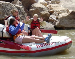
Our rafting companions were a father and daughter couple, and a pair of adventure-loving grandparents and three of their teenage granddaughters. More on the rest of the gang later.

Our trip was billed as being down the Green River, to the confluence of it and the Colorado, then down almost to Lake Powell. Instead – and with really no notice – we drove down past Moab to a put-in on the Colorado by the "town" of Potash (nothing more than a potash plant, really) where we dropped the rafts into the water and mounted up. Underwhelming beginning, actually. Although Cheese did sort of set the tone of "we ain't in town any more" by peeing in the river in front of the ladies! And gave us an introduction to Cheese.

For those of you that don't know, the Colorado (or the Green for that matter) are not clear rivers; they're full of silt they pick up from their travels. Visibility in the Colorado at our put-in was probably six inches. By Lake Powell, where the water level had declined due to drought and therefore even more silt was dissolved, it was essentially zero. So us city slickers were at first a bit hesitant to jump into the water. However, as the guides predicted, it only took about 15 minutes of 100+ degree heat to have us looking for cooling solutions. Solution number 1 of 3: Water fight! We used buckets to sling water at each other, and it was deliciously, stunning cooling in the 10% humidity.
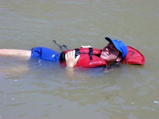
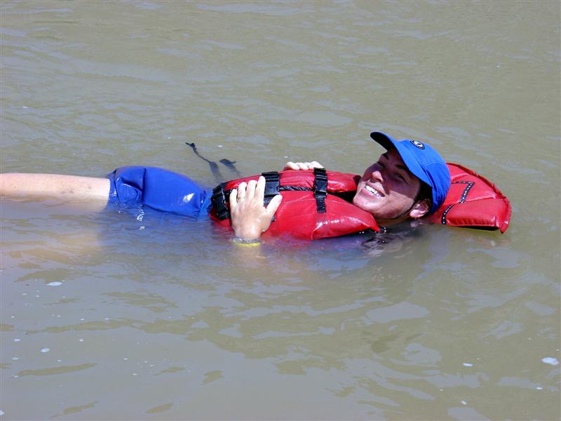
Shortly after that we turned to solution number 2 – jumping in. Our life vests automatically turned us on our backs, so we floated in bliss alongside the rafts.

We covered a fair amount of river mileage, most of it in the Island In The Sky district of Canyonlands and circling around Dead Horse Point, a particularly stunning viewpoint from the top of the mesas above us. These mesas were several thousand feet above us, so you could barely see the large canopy over the Point. We passed it from several angles during the day as the Colorado meandered its way along.
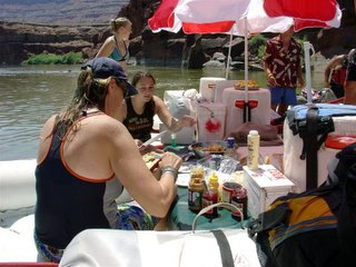
We quickly learned that eating was a major activity on the river. For our first lunch, the guides tied the three oar-powered (no motors) rafts together, put up portable poolside umbrellas, and whipped up a very nice shrimp salad in pita bread.

I decided to sleep under the stars, though I’m usually a tent person. I figured if I couldn’t sleep in the open here, then I’d never be able to do it anywhere. There were a dizzying number of stars overhead. The moon was so bright it felt like someone was shining a gentle spotlight on me. I could literally read by it, but it didn’t help me sleep much. Fortunately the moon set over one of the canyon walls before too long, and then the stars really came out. The Milky Way was as clear as I’d ever seen it, and finally in the wee hours the temperature dropped to probably the upper 50’s.

A word about useful items to have on a river trip. On a hot summer trip, experience showed us there are a few variations of common items you might not think of. Of course you’d want a water bottle in a place where daytime temperatures reached 115°. What you might not expect is that an insulated coffee mug (which Holiday provided with our tent package) is perfect: It’s insulated, which keeps the cool water from the drsinking jugs deliciously cool. It’s not too large, which means you won’t leave water in it to get warm, and it’s easy to manage in an existence where space is a precious commodity. It has a handle, which makes it easy to clip with a carabiner upside down (unless you want it seasoned with silty river water) to any available location. And finally, it’s really useful in the morning for actual coffee! The one drawback is that you have to be diligent to wash it out with the morning’s camp cleaning, else you’ll be tasting the not-too-subtle influence of camp coffee on your drinking water all day.

As Douglas Adams (creator of The Hitchhiker’s Guide To The Galaxy) said, “A towel is about the most massively useful…(complete)”. It certainly proved to be true on this trip. We used Outdoor Research bath sheet-sized pack towels made of microfiber (available at all your finer REIs nationwide) that pack small, absorb huge amounts of water, wring very dry, and even have a loop from which to hang it if you get the chance. I used it daily on the hotter days of the trip to cool me protect me from the most intense sun by dunking it in the water and covering up under it. The very low humidity combined with the heat made it my very own evaporative cooler, quite a bit cooler than the air around me. On the hottest night when the temperature never dropped below 95°, I wetted it down and slept underneath it. It worked so well, cooling me while protecting me from blowing sand, I woke up at about 3 when it dried to rewet it. And of course, when pressed you could actually use it as a towel.

Thursday, August 04, 2005

BWE Saturday 7/16: Arches, Canyonlands, & Green River

I'd have liked nothing better than to have a slow, peaceful morning at the B&B, sipping coffe on the ramada-covered porch...but nothing drives you along like the knowledge that every few minutes the temperature where you intend to hike rises a few degrees. We wanted to again visit Arches, then head out to Canyonlands, then up to Green River for the evening.

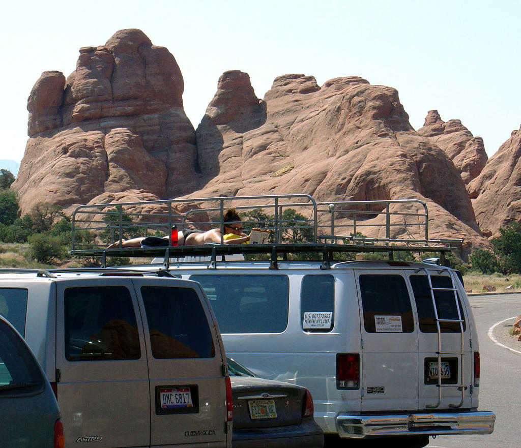
We did get out pretty promptly (for us), so it wasn't TOO hot by the time we got to the Devil's Garden parking lot for our hike out to Landscape and Double O arches. One demented sun-worshiper was even working on their tan in a bikini while reading Bulfinch's Mythology. The paramedics must have taken her away by the time we returned, because she wasn't up there.


As you might expect, the trail began pretty crowded with families of all shapes and sizes, many with only flip-flops, a little water bottle, and no head coverage. We looked overdone in comparison with hydration packs, boots, hats, and walking staffs...but I know we were more comfortable. There's just something sinful about being able to take a drive of cold water out in the middle of the hot desert!

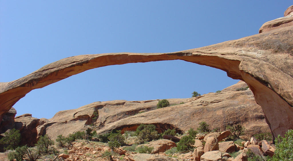
Landscape Arch is long and delicate (remember I said it was originally supposed to be named Delicate Arch), and you can't go under it any more after a rockfall (on the right) caused many tons of it to shave off in the 70's. It's very sandy at the observation area, so it felt especially especially hot.


We didn't linger long here, but continued onward towards Double O Arch. The trail immediately becomes less manicured (i.e., more interesting) and less populated (i.e. more peaceful), and we clambered up and down through slickrock valleys and ridges, and along narrow rock fins to get to our destination. Hiking on the slickrock formations in Utah is like a playground for grownups!


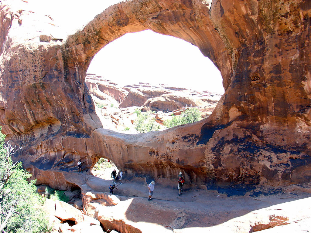
Double O Arch is named for the two holes in a slickrock fin that wind and rain have carved over time. Smooth and beautifully rounded, it's quite comfortable to sit in the smaller "O" and relax. You're in the shade, and the opening (which was created by the wind, after all) focuses the breeze nicely on you. We had lunch there and clambered around on the beautiful formations.

The day was heating up rapidly, so we hustled back to the crowds and the parking lot. A great way to spend the morning, but we still had Canyonlands to go.

After a relaxing lunch in Moab, we headed out to Canyonlands. This NP is north and west of Moab, and . It's huge (527 square miles!), has little in the way of tourist facilities, and is forbiddingly hot in the summer and remote. It's also an amazing place. When people think of vast canyons, of course they think of the Grand Canyon. It's still my favorite, but Canyonlands is awe-inspiring in a different dimension: instead of one gigantic, hard-to-comprehend canyon, viewing Canyonlands from Grand View point brings you innumerable smaller canyons as far as the eye can see across 270 degrees of view. And "smaller" is a relative term; most of them are well over 1000' deep. If you look carefully at the photo in the Grand View point link, you'll see fine lines around the aptly-named White Rim. That's a jeep track that's wide enough to hold two jeeps side by side most places!

Canyonlands is split into three districts by the Green and Colorado rivers, which form sort of a "Y" in the park. The place where the two rivers meet is known as the Confluence. The upper section is called Island In The Sky because it's on a huge mesa that overlooks all the canyons. Grand View Point is on the southern tip of the mesa. The lower right is the Needles District, named for the needle-like formations found there. If you look at the map of the Grand View point photo, you'll see markers for the confluence on the right...but you still can't even see any rivers because it's so convoluted.
And the lower-left (southwestern) district is aptly named The Maze, for its many little-explored maze-like canyons. The Maze is the least accessible, and least visited section of land in the lower 48. It really wasn't even explored until the late 50's and early 60s. The ranger station on the west side is a 2 1/2 hour drive from the closest town, the last 46 miles on a dirt road. The canyons of The Maze are another 3 to 6 hours using high-clearance 4WD vehicles. We got close on the east side by floating down past the confluence to Spanish Bottom, hiking 1000' to the top of the river canyon, hking another mile or so inland...and we still didn't get to where we could see any of the maze canyons. (More on this later.) Edward Abbey in Desert Solitaire has an excellent chapter on what it was like to explore the district in the late '50s.

So. All us tourists did before we started the raft trip is drive into the paved roads of the Island In The Sky district, take a few photos, and zoom up to Green River!

Monday, August 01, 2005

BWE Friday 7/15: Moab and Arches NP

Our trip was really split into two parts. The first section was a six-day rafting trip down the Colorado River through Canyonlands National Park to the beginning of Lake Powell, and the second was doing various kinds of touristy hikey things in Yellowstone and Grand Teton NP. This made preparations rather schizophrenic, as there wasn't a lot of overlap between the two types of gear beyond hiking boots!

After arriving in Salt Lake City uneventfully, we drove down to Moab. Eventually. We managed to miss the turn off from I-15 to US 6 at least three times, and added at least an hour to our drive. Connor was asleep; when he woke up he was astounded (and dismayed) to find we were basically in the same place he'd fallen asleep! But really we had worked hard in the mean time, at $2.50 / gallon.

This vacation was also an exercise in temperatures. In SLC it was in the low to mid 90's when we left; when we arrived at the Arches parking lot it was 110 degrees at about 5 PM. We hung around long enough to get our bearings and a map, then drove into town to the B&B we were staying at. Sunflower Hill is a beautiful multi-structure B&B in the north end of Moab. We had a room called The Garret, which as you might think is located on the top floor of one of the buildings. It was very nice, and Connor had his room (which he loves).

But alas, the theme of this vacation was "Don't stand still!" so we were never in one place long enough to really relax. Too much to see!

We went back to Arches in the evening to hike out to Delicate Arch in that precious time, when the sun has lost most of its heat but it's not dark out yet. Plus you get the added benefit of seeing the park near sunset when the shadows make the views more dramatic. This shot of Balanced Rock (left) was taken out the window at about 45 MPH while speeding to the Delicate Arch trailhead before sunset.

We hustled out to the arch just as the sun had set, climbing up a long slickrock rise to get there. This arch, the best known in the world probably, is perched at the edge of a pretty significant dropoff, so it's an interesting experience walking around on the sculpted sandstone surface around it. Interesting factoid: Delicate Arch was originally supposed to be named Landscape Arch, and the other (which really is much more delicate) was to be named Delicate. But someone got them mixed up, and it stuck.

A nice feature of this arch is that, despite its fame, it isn't all roped or fenced off. You can walk right up to its base and touch it. Perhaps it benefits from its mild difficulty getting there from the heat, the altitude of 4600 feet, and the minor climb: you probably won't be standing next to a fat guy smoking a cigarette (FGSC).
We stuck around until it was a little too dark, then made our way back. Even though it's a pretty well-used trail, in the serious dark of the desert and the slickrock made the trail hard to find at times. I used my handheld GPS to retrace the route I'd taken out there, and we were back to the car in no time with a good view of stars to boot.

This was Connor's first hike in quite a while, and he's grown up quite a bit. He's MUCH taller and stronger, and we were pleased with how he could keep up perfectly well.


It meant we could ramp up our hiking plans just a bit!

Sunday, July 31, 2005

Float, hoof, and Shank's Mare: the Big Western Adventure

We've just returned from the last trip of my two-month sabbatical, a two week rafting / riding / hiking vacation throughout Utah and Wyoming (with cameo appearances by Idaho and Montana). And tomorrow I start back at work :(.

It's been a surprisingly busy sabbatical, both from traveling and from self-driven projects. Overall, we've been on the road for 50% of June and July, so I shouldn't feel too bad that

- My office is messier than before I started sabbatical
- The house is far from immaculate
- My project list is far from complete (The garage workbench is still two feet deep in junk)
- I've completely muffed a writing deadline (ouch, chagrin, and embarrassment)

But I do!

However, I have managed to keep a travel journal for almost every day of our Big Western Adventure (BWE). Since I had neither the means nor the desire to post to this blog when I was 50 miles away from civilization in every direction - that was the point of the vacation, after all - I'm retroactively posting to it on a more-or-less daily basis as I transcribe my handwritten journal.

Sunday, June 19, 2005

Hot summer? This will cool you off

Our friend Eric, the overwinter manager at McMurdo Station in Antarctica, has sent an update to his blog. Fascinating! I'm going to ask for the"originals" of his outdoor photos.


http://www.travelblog.org/fred.php?id=11346